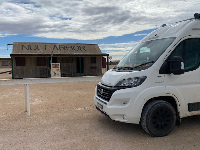
The Nullarbor
A Von Blog.
Well, we finally got to Western Australia. I did not get to it as a backpacker in 1990, we did not manage it during our sojourn in Sydney between 2009 and 2012 and, this time, we have only been waiting a mere 18 months to get here...
To achieve it meant driving one of the most iconic roads in Australia, nay, the world! But what is it about this particular road, the Eyre Highway, which makes it so? Firstly, the sheer length of the thing, some 1675kms, including one section, the 90 mile stretch, which has NO, and I mean, NO bends or corners. 146km of straight road.
The second thing to think about is the alternative routes. Mmm. If you are looking for bitumen (tarmac to our European readers) then the only other east/west crossing is just a mere 2099kms north (oh, and you can only go north from Port Augusta). To put that in some perspective for those non-Aussies, we drove from (A) Bosnia & Herzegovina to (B) Spain but if we had wanted to use the alternative road then we'd have had to drive back to Serbia and then drive north through Slovakia, Hungary, Poland, cross the Baltic Sea and into Sweden before being able to turn left (C) to drive through Scandanavia, the North Sea, northern England and into Ireland...you get the picture. She's a bloody big country and there's not many roads.
It should be said however, there are 4WD tracks in the bit in-between but not accessible to us in Cilla. And, in any case, it's full of Outback Truckers!
Thirdly, it's only been a fully sealed road since 1976, younger than me but looking just as haggard. The written history of the Nullarbor would suggest it was "first" crossed by Edward Eyre and his "Aboriginal companion" Wylie in 1840. I don't know much about these things but am guessing it had been crossed many times in the previous 150,000 years by the First Nations people and that the relationship between Eyre and Wylie was a little more complex than "white guy and his trusted companion". It wasn't Eyre that named it the Nullarbor though (he just had the highway named after him), no, it was Surveyor Edmund Delliser who is credited with the latin naming Nullarbor, no trees.
We have spoken to plenty of Aussie travellers who (invariably) complain about how boring the journey is, how tedious, how mind numbing. I can see their point but, having done it, I can counter with how magnificent it is. Magnificent you say, are you sure? There is something about driving for such a long way and only seeing scrub. The scrub though is a hue of varying greens and greys with the pop of the red earth and the expanse of blue sky.
Every 200km there's a roadhouse to break the journey. Early travellers had to carry their fuel with them and then hoped to top up when they came to Sheep or Cattle Stations. The Station owners obviously realised there was money to be made and so the Stations gradually became Roadhouses offering fuel, food and accommodation. All are independently owned and, mostly, look like they would have looked in the 1970s. Swish they are not.
 |
| Border Village Roadhouse - this is one of the prettier ones... |
That said, if you are in need of a hot pie, a coffee or to top up the tank then they are everything you need. I thought it interesting that the big multi-national fuel/fast food companies have not yet taken them over hence why they look like they do. Something to cherish in our cookie cutter world where every major town or city looks much like any other. Being as they are also results in 'quirky' - and you know how much we like quirky.
 |
| Eucla Roadhouse. I am sure it made sense to someone... |
 |
| Nicely sums it up |
The road was not busy, certainly nowhere near M1 like numbers, but still a reasonable number of other travellers. Wobble boxes abound (a lovely term for caravan that I saw recently) as do camper vans, motorhomes, huge fifth wheelers, Utes with ubiquitous roof tent and, of course, lots of lorries. Not your average lorry; huge road-train trucks, some four trailers in length, that travel throughout the day and night. Many have a two watch system, one driver drives while the other sleeps and carry everything from food, building materials, vehicles, even army trucks. As I saw on a truck this morning "without trucks, Australia stops". It seems a shame the rail infrastructure isn't up to the job of carrying more.
 |
| Four trucks for the price of one |
The thing I found most frustrating was the sheer amount of rubbish lining the highway. Drivers, who having finished their can or bottle of drink, apparently think nothing of throwing it out of the window. Broken glass abounds which is not only bad for wildlife but is also potentially dangerous given the strength of the sun, the dryness of the vegetation and the propensity for bush fires. There's also the many wee filled bottles. I continue to be astounded why these blokes (and it must be blokes because you'd be a pretty amazing woman who could drive a truck and simultaneously pee into a bottle), anyway, why these blokes think it's ok to be so disrespectful to country. What do they think happens to the bottles once they fling them? And if they must relieve themselves in such a way, why not leave the bottle in the cab until they get to the next bin? Grrr. As you can tell, it vexes me a great deal. Almost as much as the confetti like toilet paper which litters each, and every, road side stop and camping area. A horrible side effect to having so many people travelling, coupled with very few public toilets, means those without onboard facilities use the great outdoors to relieve themselves but without clearing it away. I am guessing it's a bit of a health hazard as well as painting a pretty poor picture of Australia and Australians. (This particular phenomenon used to be blamed on foreign backpackers but given there aren't any here at the moment would suggest Aussies are just as good at soiling their own backyard).
 |
| More travellers need to know how these work... |
The disappointment in our fellow human beings was more than outweighed by 'pinch me' moments during the journey.
The Head of the Bight is a marine conservation area and is the berthing grounds for the Southern Right Whale. Every year, the whales travel from breeding grounds in Antarctica, northwards to the Bight where they calve, spend time in the 'nursery' teaching their young the tricks of survival before returning to the polar region for the next cycle. Recently, scientists were able to put a GPS tracking device on a whale and followed a journey of some 15000kms!
 |
| She is there, honest! |
We were very fortunate to spot at least six adult whales and a couple of calves but by August this number is likely to increase tenfold and there can be anything up to 100 whales; a sight to behold indeed.
 |
| Camping on the edge of a continent |
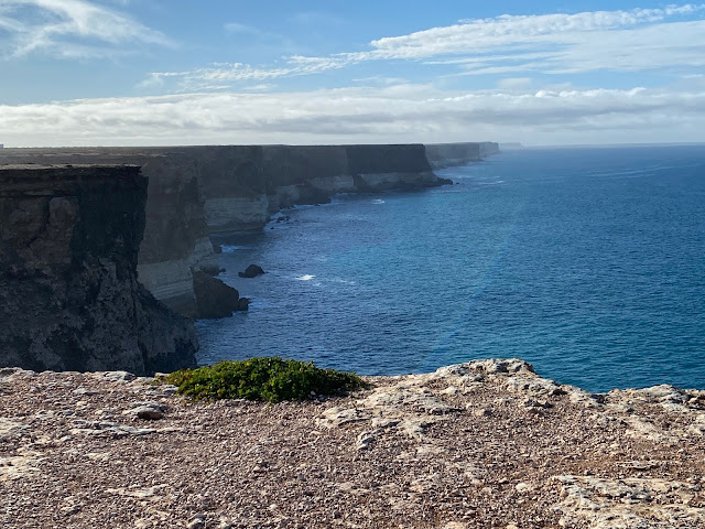
The other amazing highlight was camping at the Bunda Cliffs.The stretch of cliffs extends for nearly 800kms and can be as high as 100m. For the geologists, they are composed of three types of limestone. The base of the cliffs is Wilson Bluff limestone formed when sea levels were higher and skeletons from billions of marine organisms were deposited to form the limestone. Next up is Nullarbor limestone, formed about 25million years ago and, again, due to the inundation of the Southern Ocean and sedimentation. The cliffs are capped by the Bridgewater Formation, formed between 1.6million and 100,000 years ago it consists of a hardened layer of windblown calcareous sand.
 |
| The three layers of limestone and stretching as far as the eye can see |
There you have it, my impressions of the Nullarbor. We won't be going back on it, hopefully, instead we'll be doing the drive clockwise and taking in the sights, sounds and smells of Western Australia and then the Northern Territory. More adventures await!


Comments